Kesagami River Water Shed

(from Kesagami Lake to James Bay)

Kesagami River 2005

A Compilation and Interpretation of Baseline Water Chemistry and Quality Data from the Kesagami River and Comparison of these data to Ontario Provincial Park River Quality Standards.

Tyler Smith
Environmental Science, Acadia University
Wolfville, Nova Scotia

Introduction

In the summer of 2005, I had the unique opportunity to lead a nineteen day canoe trip on a remote, northern Ontario river. The trip spanned the Little Kesagami River, Kesagami Lake, and Kesagami River (see yellow line on Figure 1.), which are located near the Ontario and Quebec boarder and drain into James Bay. This trip will be repeated in the summer of 2006.

An initial literature review indicated that very little was known about the natural environment in this region. As such, I approached Dr. Spooner in the spring of 2005 to determine if a research project could be initiated that would take advantage of my access to the river in 2005 and probable repeat trip in 2006.
I had also paddled the Kesagami in 1999 as a camper, and therefore had first-hand knowledge of the remoteness and rugged geology of the river, and sought to learn more about the unique and relatively unstudied river system. Dr. Spooner and I determined that an initial baseline survey of water quality and chemistry on the river systems (and associated tributaries) would provide enough background data to determine if an extended survey was appropriate. We also determined the basic protocol that was to be followed when collecting water samples and associated data. The project is focused on the determination of the relative influences of geology and landscapes alteration on the water quality and chemistry of a boreal river.

Background

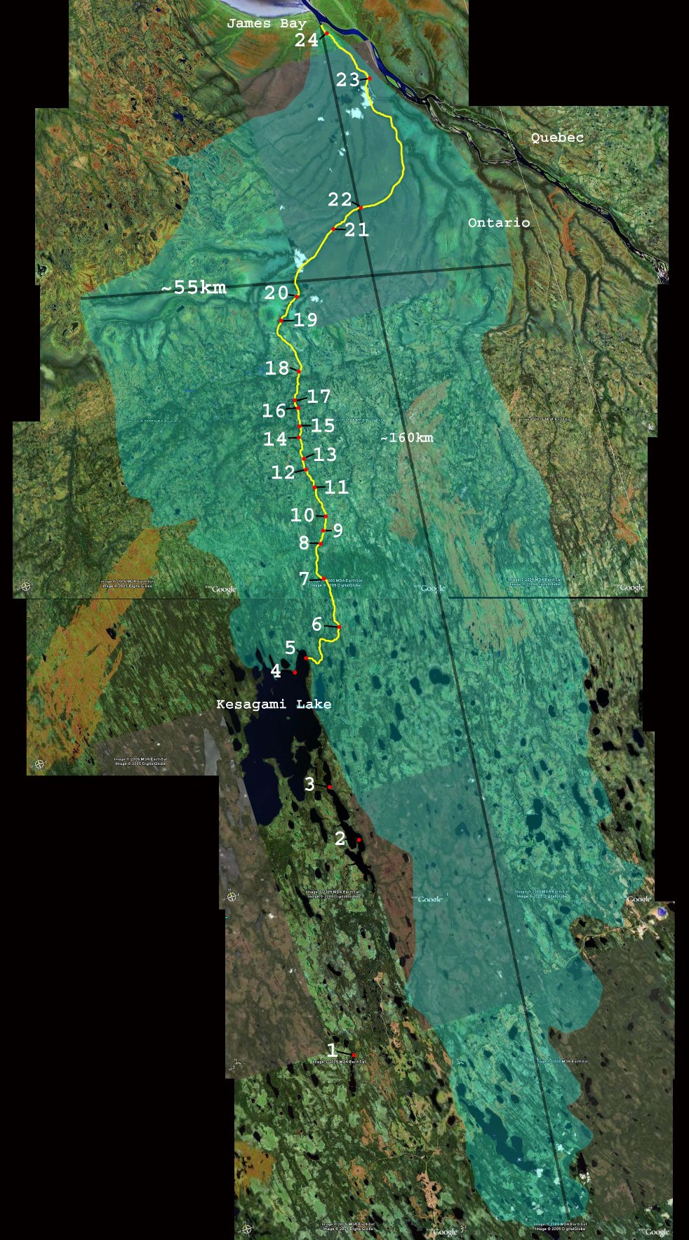
Figure 1. Canoe route on the Kesagami River as traveled in the summer of 2005 with marked sampling sites. Kesagami River water shed (from Kesagami Lake to James Bay).

Methodology:

Results and Interpretation:

Affiliations:

Conclusions: