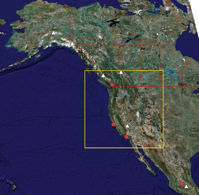
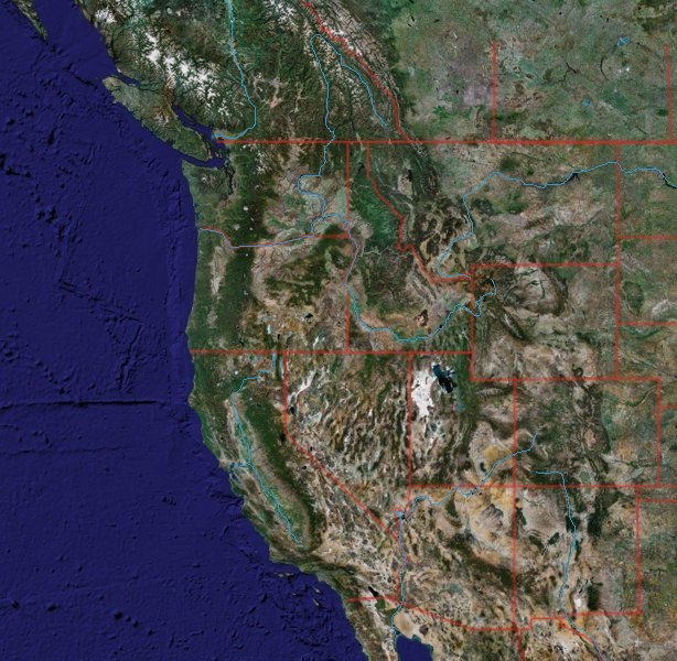
Significant Places and Features for Global Tectonics (Western North America) - Quiz 6
Click here to go to the maps index.
Go to Map Index
Go to Map 5 (Asia)
Go to Map 7 (Nova Scotia)
Go to Places list 6 (Western North America)
Alaska Peninsula
Locus of volcanic activity
above eastern end of volcanic arc of the Aleutian subduction zone, making Alaska the most volcanic state in the US and the US the country with most volanoes
Aleutian Trench
subduction of Pacific floor
under North America
Athabasca River
drains Rockies to Lake Athabasca
Baja California
peninsula west of Mexico, formed by rifting on East Pacific Rise
Bow River
drains southern Canadian Rockies
Brooks Range
northernmost range in Alaska, extension of Rockies-Mackenzie Mountains
Calgary
sits just east of the Canadian Rockies
Foothills
Canadian Rockies
easternmost range of
Cordillera in Canada
Colorado Plateau
Plateau uplift in past 5 m.y. in SW USA, incised by Colorado River
Colorado River
river incised into Colorado Plateau, as it rose to present elevation over
the past 5.5 m.y.
Columbia River
principal drainage in NW USA, originating in Southern Rocky Mountain Trench
Denali
current name for highest mountain in North America (once Mt. McKinley), SE
Alaska
Denver
sits just east of the US Rockies Foothills
East Pacific Rise
ocean spreading ridge, extending from South Pacific to Mexico
Fraser River
major drainage basin in BC, flowing partly along the Fraser River-Straight
Creek fault system
Great Bear Lake
northernmost of the shield-margin great lakes, lying west of the Slave
Province
Great Slave Lake
one of the shield-margin great lakes, lying south of the Slave Province
Gulf of California
also known as Sea of Cortez, a narrow rift sea where Baja California has
split from Mexico along East Pacific Rise
Haida Gwaii
formerly known as Queen Charlotte Islands, archipelago west of BC
Hawaii
mid-ocean hotspot volcanic island chain
Kodiak Island
Accretionary prism of Gulf of
Alaska
Lake Athabasca
one of the shield-margin great lakes, north of the Athabasca Basin
Lake Winnipeg
one of the shield-margin great lakes, lying in southern Manitoba
Los Angeles
southern California
Mackenzie Mountains
Foreland fold and
thrust belt of northern Cordillera
Mackenzie River
longest river in Canada, draining western Canada and the western Shield
toward the Beaufort Sea
Mendocino Fracture Zone
fracture zone extending from triple point west of the California coast
Mexico City
located in an ancient lake bed north of the Trans-Mexico Volcanic Belt
Missouri River
draining northern US Rockies
Molokai Fracture Zone
fracture zone extending from Baja California to Molokai ("second island" in
Hawaii)
Mount Logan
highest mountain in Canada (Yukon)
Mount Robson
highest mountain in the Rockies (SE BC)
Mount Whitney
highest mountain in the lower 48 states (California)
Mount Waddington
highest mountain entirely in BC
Murray Fracture Zone
Extending from Pt. Arguello, California, to north of Hawaii
Popocatepetl
Volcano overshadowing Mexico city
Rio Grande
River forming US-Mexico border and lying in rift valley in Colorado Plateau
San Francisco
central California
Saskatchewan Rivers (North and South)
Major drainage system of southern Canadian Prairies, draining into Lake
Manitoba
Snake River
drains the Idaho potato belt, and flows through North America's deepest
canyon on the way to join the Columbia
Trans-Mexican Volcanic Belt
high volcanic belt crossing southern Mexico
Vancouver
On North American mainland, southwestern
BC
Vancouver Island
Island west of Vancouver
Yukon River
Originating in BC, crossing Yukon and mostly in Alaska, the longest
westward-draining river in the Americas

